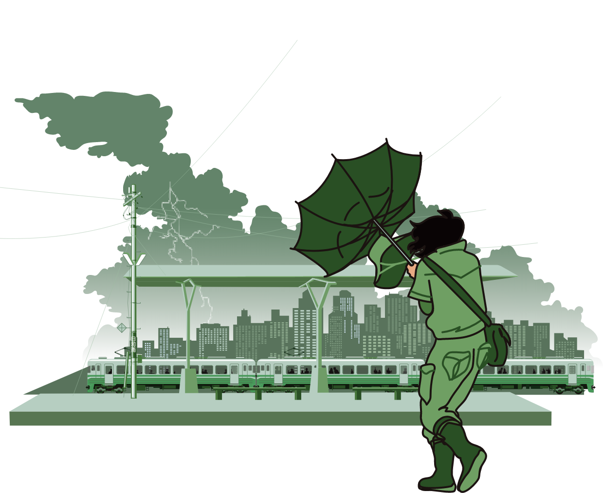
Weather & Disaster Information Distribution
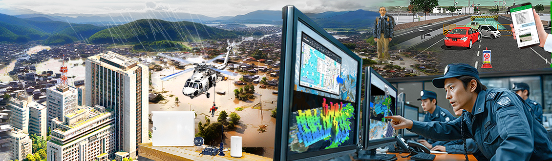
Monitoring Solutions for Community Disaster Preparedness
Detect early signs of disasters and enable rapid response.
SANGIKYO combines communications technology with sensors, video, and AI to detect early signs of disasters, supporting timely evacuation decisions and efficient information sharing.
What we provide is not simply the installation of equipment, but a comprehensive framework that enhances a community’s disaster preparedness.
Solutions
Ultra-High-Density Weather Observation & Information Service
“POTEKA®”
It collects and visualizes real-time weather data, allowing detailed assessment of local weather risks.
It also supports information delivery via LINE and the web, enabling rapid notifications to residents.
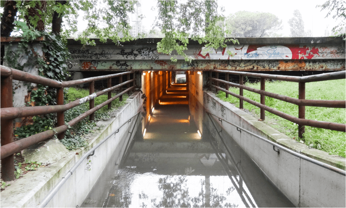
River & Underpass Monitoring System
Video distribution via YouTube and alert notifications via LINE support timely evacuation calls for residents.
By using Wi-Fi HaLow for video transmission, the system can be operated over a wider area at lower cost.
This proof-of-concept technology was also selected under the Regional Digital Infrastructure Utilization Program.
Reservoir Monitoring System
Designed for priority disaster-prevention irrigation reservoirs, this system remotely monitors water levels and provides video feed.
When thresholds are exceeded, LINE notifications are sent automatically, allowing situational awareness without on-site visits.
The system helps reduce the burden on local disaster management personnel.
Ultra-High-Density Weather Observation & Information Service
“POTEKA®”
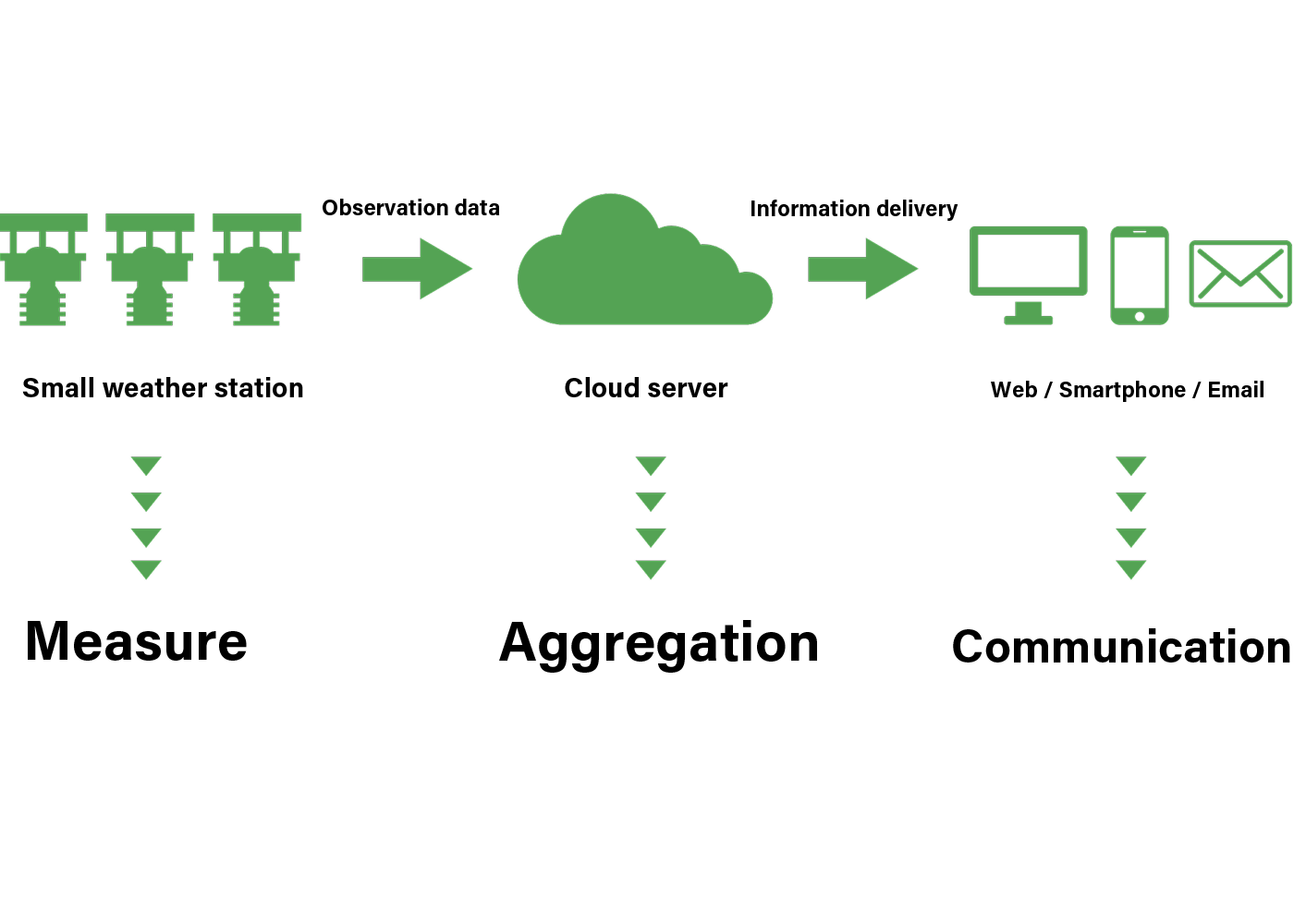
Service Overview
Weather data captured by the compact weather station is stored in a cloud server, undergoes quality checks, and is then distributed online.
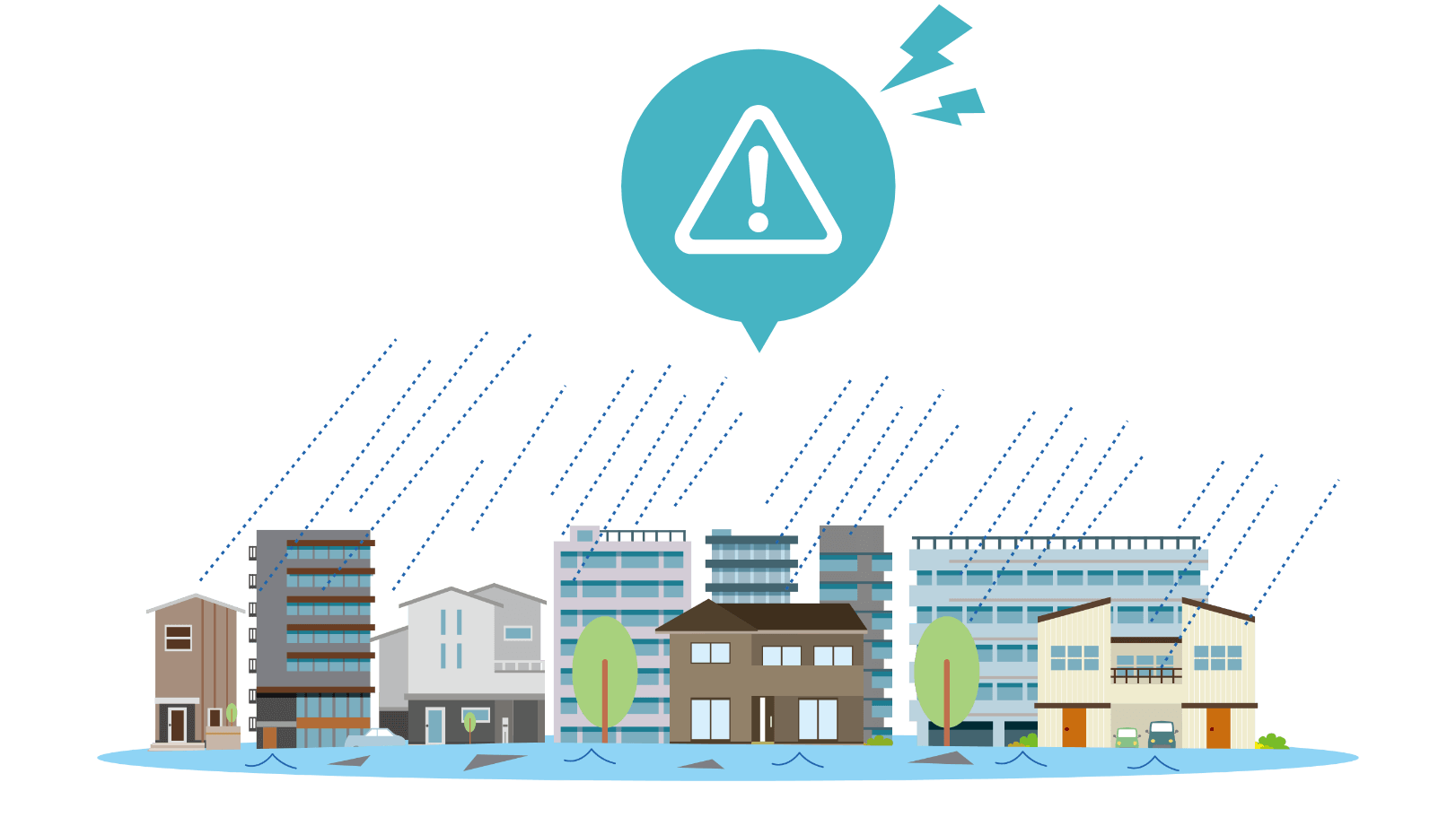
What Kind of Weather Information Service Is Needed Nowadays?
In recent years, disasters causing severe damage have occurred frequently nationwide.
With conventional weather data alone, it may be increasingly difficult to commensurately respond to sudden, localized weather changes in small areas.
To protect lives and communities, what is now required is:
'- Real-time weather information obtainable at any chosen location
- Accurate and rapid information collection
- Information sharing and communication regardless of time or place
POTEKA® meets these needs and is expected to play an important role in protecting our daily lives and safety.
Three Key Points
The unit measures 20.0 cm in diameter and 27.1 cm in height, weighing just 1.35 kg—a compact and lightweight design.
By installing it where weather conditions need to be monitored, pinpoint-accurate weather data can be obtained.
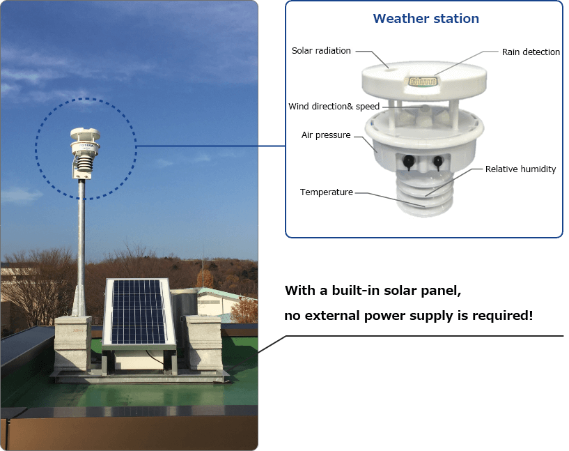
Examples of installation locations:
Utility poles

Outdoors

Rooftop of buildings

The weather station measures and collects seven types of weather data at the installed location and notifies changes via email.
Because data is updated every minute, localized conditions can be monitored in real time allowing to prepare for sudden weather changes.
Observable Weather Data
Aggregation
Heat index
Cumulative rainfall
Rainfall intensity
Weather conditions
Data observed by POTEKA®, along with AMeDAS data issued by the Japan Meteorological Agency and other sources, river water levels, and hazard distribution information, can be accessed through POTEKA NET.
Provided an internet connection, accurate weather changes can be monitored from anywhere.
What Is “POTEKA NET,” the All-in-One Disaster Information Platform?
Scenario-Based Use Cases
In addition to disaster preparedness, the system can be used in a wide range of situations to meet the needs of organizations and communities.
Local Governments
- Analyze local weather-change patterns based on data gathered.
- Provide timely and adequate evacuation guidance to residents.
Schools
- Use as educational material for science classes.
- Support smoother advance decision-making (event cancellation, school closures, etc.).
- Use POTEKA® “heatstroke alerts” to send awareness emails.

Construction Sites
- Improve safety checks for outdoor work.
- Monitor on-site weather conditions.

Transportation Operators
- Support operational management in response to changing weather conditions.
- Provide weather information on internal monitors.
In addition, the system is also used in many other settings, including medical facilities, farms, and tourism/leisure sites.
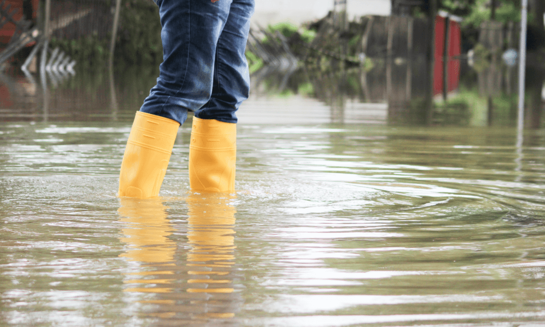
“Once-in-XX-years abnormal weather,” “record-breaking rainfall,” and more.
Are you fully prepared for intensified and increasingly frequent torrential rain and river flooding?
POINT1
POINT2
SANGIKYO’s disaster communications system,
the “River Monitoring Package,” enables sharing of hazard information.
Real-time monitoring and distribution of water levels, and video feed of rivers and similar areas
Also applicable to the monitoring detention basins and irrigation reservoirs
Inland flooding
Underpass flooding
Service Features
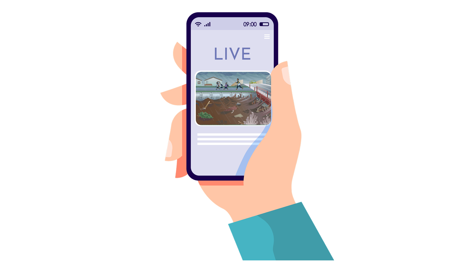
Deliver river video feed and alert information to residents
“We want to effectively encourage evacuation before the danger becomes imminent.”
- Stream real-time river conditions via YouTube and automatically deliver LINE alerts to raise awareness of risk.
“We want to use past data to improve future flood prediction.”
- Accumulate and analyze water-level gauge data for disaster forecasting.
Remote monitoring through live video streaming
“During heavy rain, I’m worried about our local river… but going to check on-site is dangerous.”
“Monitoring is essential to accurately assess flooding conditions!”
- Real-time remote monitoring via YouTube live streaming
- No need for dangerous on-site checks; improving the safety and reliability of monitoring operations
Service Overview
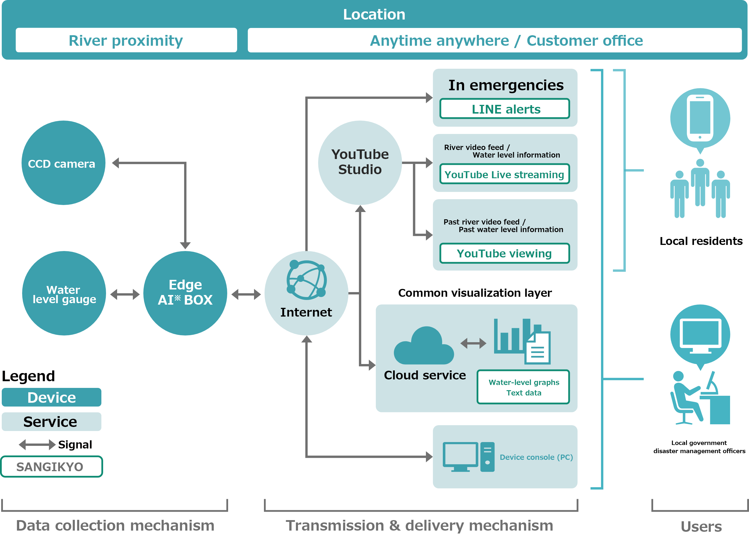
*Edge AI: A technology in which AI is embedded in IoT devices and sensors, enabling the devices themselves to learning and interpret. Because AI processing is carried out on the device side, there is no time lag between decision-making and receiving the result. In addition, only the data necessary for learning is sent to the cloud, helping reduce communication costs.
Implementation Process
01Inquiry
We listen to your needs and challenges through online meetings or on-site visits.
From the two perspectives of weather observation and information sharing, we propose the optimal service solution to address your issues.
02Site Survey
After the contract is signed, we will register your information in our system. This allows for seamless sharing of weather information at any time.
03Design & Quotation
We will install POTEKA at the specified location. You will be able to check observation data immediately after installation. (note - I believe there may be a repetition here and in point 04).
04Proposal
We will install POTEKA at the specified location. You will be able to check observation data immediately after installation.
05Installation Work
We will install POTEKA at the specified location. You will be able to check observation data immediately after installation.
06Start of Operation
We will install POTEKA at the specified location. You will be able to check observation data immediately after installation.
Service Overview
In recent years, reservoir failures caused by heavy rain and earthquakes have occurred frequently nationwide, increasing the risk to life and property damage. In particular, agricultural irrigation reservoirs face challenges due to aging managers and labor shortages, which weaken inspection and monitoring systems.
Our Reservoir Monitoring System uses ICT to enable remote water-level monitoring, video confirmation, anomaly detection, and information delivery to residents—supporting disaster prevention and mitigation measures for reservoirs.
Key Features
Safe inspections through remote monitoring
> The system also supports emergency inspections during earthquakes and heavy rain, enabling fast response without visiting the site.
Water-level monitoring and LINE notifications
When configured thresholds are exceeded, LINE notifications can be sent immediately to managers and local residents.
Improved evacuation awareness through live video feed
>The system is also effective in overcoming normalcy bias, leading to quicker evacuation decisions.
High-security design
This prevents unauthorized access to surveillance cameras and enables stable operations.
Personal data protection
This allows video distribution while protecting residents’ privacy. Video data is automatically deleted after being stored for 30 days.
Subsidy support available
Some programs cover up to 100% of eligible costs, significantly reducing implementation obstacles.
Overall System Configuration
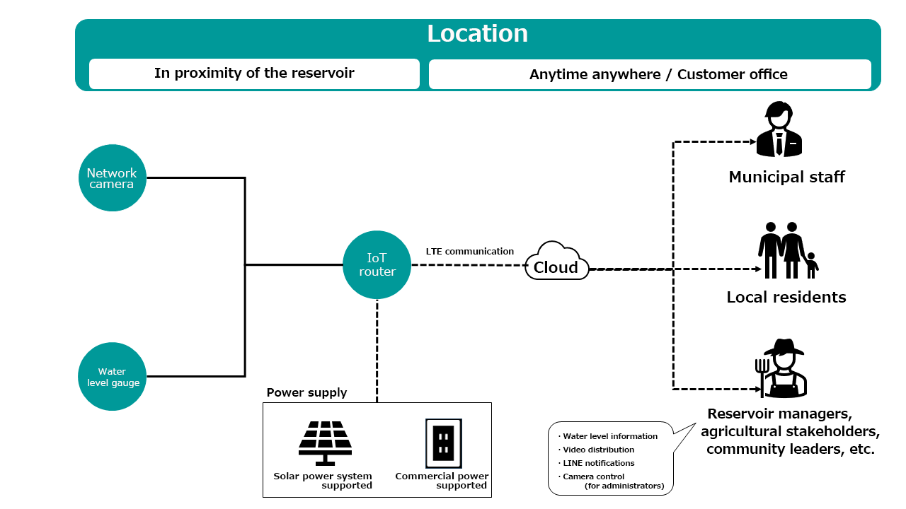
Main Components
- Multi-sensor camera / Fisheye camera
- Radio-type water level gauge
- IoT router (LTE supported)
- Solar panels and storage batteries
- Cloud integration system (video distribution, water-level data management, notification control)
Use Scenarios
- Monitoring of priority agricultural reservoirs for disaster prevention
- Emergency inspections in case of earthquakes and heavy rain
- Delivery of evacuation information to residents
- Prevention of fall accidents (psychological deterrent effect of surveillance cameras)
Frequently Asked Questions
What kinds of engineers do you have?
We dispatch engineers with expertise in communications equipment, electrical work, civil engineering construction, and fire department radio systems, depending on the requirements of each project.
Are there any limitations on regions or areas you can cover?
We provide nationwide coverage. We can flexibly support special conditions, including remote areas and islands. We conduct a site survey in advance and build the optimal implementation structure.
Can you also coordinate with the Fire and Disaster Management Agency and local governments?
Yes. We can handle necessary administrative procedures, coordination with relevant organizations, and preparation/submission of technical documents. Our experienced staff will assist you every step.